
















Where Is This Place
What is Where Is This Place?
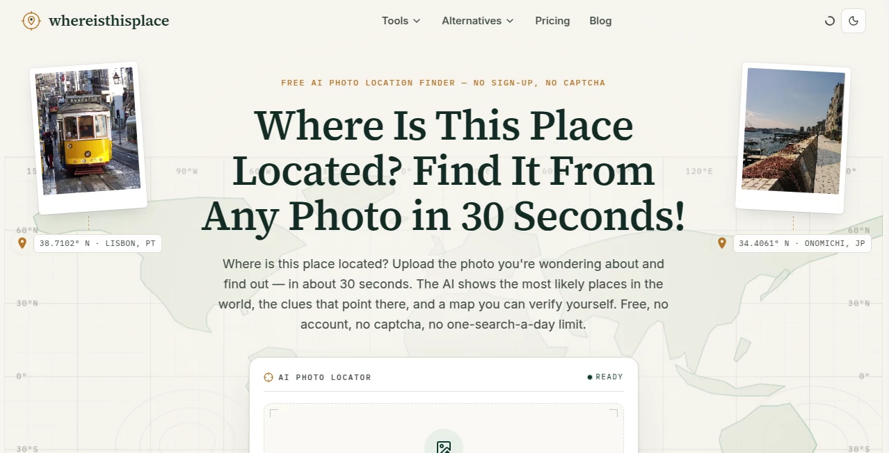
Have you ever looked at a beautiful travel photo, an old family picture, or a mysterious landscape and wondered where it was taken? This intelligent platform makes that question remarkably easy to answer. By combining advanced computer vision with geographic intelligence, it analyzes visual clues such as landmarks, architecture, vegetation, road layouts, and environmental patterns to identify the most likely location of an uploaded image.
Instead of relying on manual research or reverse image searches, users receive location predictions, GPS coordinates, confidence scores, and interactive map results within moments. Whether you are a traveler trying to rediscover a destination, a journalist verifying media, a photographer organizing archives, or simply someone satisfying curiosity, the experience feels fast, reliable, and surprisingly intuitive.
The technology has been designed to recognize places from virtually anywhere in the world, making it valuable for both casual users and professionals who require dependable geographic analysis.
Key Features
- AI-powered photo geolocation analysis
- Interactive map with GPS coordinate results
- Landscape and flora recognition
- Architectural pattern analysis
- Landmark identification
- Confidence score with reasoning behind predictions
- Global location recognition across 195 countries
- Fast cloud-based image processing
- Multiple subscription plans for different usage levels
- Designed for research, travel, and investigative workflows
User Interface
The interface focuses on simplicity. Uploading an image requires only a few clicks, and the entire workflow is presented in three straightforward steps. Navigation is clean, the upload process is smooth, and the final results are displayed alongside an interactive map that helps users understand exactly how the location was identified. Even first-time visitors can begin using the platform without any learning curve.
Accuracy & Performance
Performance is one of the strongest aspects of the platform. Rather than depending on a single recognition method, it evaluates multiple environmental indicators simultaneously. Mountain ranges, vegetation, shadows, roads, buildings, and local architectural styles are all considered before generating a prediction. The platform also provides confidence information, allowing users to better understand how reliable each result may be. According to the official website, the underlying models are trained using billions of panoramas, satellite images, and geo-referenced assets to improve worldwide recognition capabilities. :contentReference[oaicite:0]{index=0}
Capabilities
The platform is capable of identifying famous landmarks as well as less recognizable outdoor environments. It can estimate GPS coordinates, provide supporting evidence for its predictions, and help users narrow down potential regions even when no obvious landmark appears in the image. This makes it useful not only for tourism but also for digital investigations, historical research, educational projects, and media verification.
Security & Privacy
User privacy is taken seriously. Uploaded images and personal information are handled according to the platform's privacy policy, which explains how image data, metadata, and search information are processed. This provides transparency for users who work with sensitive or private photographs. :contentReference[oaicite:1]{index=1}
Use Cases
- Finding the location of travel photographs
- Verifying images for journalism and media
- Supporting OSINT investigations
- Organizing photography collections
- Educational geography projects
- Researching historical locations
- Identifying landmarks before planning trips
- Exploring unknown places shared on social media
Pros and Cons
- Pros
- Very easy to use
- Fast image analysis
- Interactive GPS mapping
- Global geographic coverage
- Excellent combination of computer vision and mapping technologies
- Useful for both professionals and everyday users
- Cons
- No completely unlimited free usage
- Accuracy depends on image quality and visible environmental details
- Indoor photos with limited visual clues may produce less precise results
Pricing Plans
Several pricing options are available depending on search volume. Subscription plans include Starter, Pro, and Expert tiers, while one-time search credits are also available for users who do not require a monthly subscription. This flexible pricing makes the platform suitable for occasional users as well as professionals who analyze large numbers of images. :contentReference[oaicite:2]{index=2}
How to Use Where is this place?
- Upload a photograph or paste an image link.
- Allow the AI to analyze landmarks, landscapes, vegetation, and structures.
- Review the predicted location.
- Explore the interactive map and GPS coordinates.
- Use the confidence score and supporting information to verify the result.
Comparison with Similar Tools
Many image recognition services focus primarily on identifying objects or performing reverse image searches. This platform takes a different approach by specializing in geographic reasoning. Instead of simply matching similar images, it studies environmental characteristics, architecture, vegetation, and spatial patterns to estimate where a photograph was taken. That specialized focus makes it particularly attractive for travelers, photographers, researchers, investigators, and anyone who regularly works with location-based imagery.
Conclusion
This platform delivers an impressive combination of artificial intelligence, geographic analysis, and user-friendly design. The workflow is straightforward, results arrive quickly, and the supporting evidence helps users understand how conclusions are reached instead of presenting unexplained guesses. From satisfying personal curiosity to supporting professional investigations, it offers a practical solution for identifying locations from photographs with remarkable speed and convenience. For anyone interested in discovering where an image was captured, it stands out as an innovative and dependable choice.
Frequently Asked Questions (FAQ)
Can the platform identify locations from ordinary travel photos?
Yes. It analyzes landscapes, buildings, roads, vegetation, and many other visual elements to estimate where the image was taken.
Does it provide GPS coordinates?
Yes. Results include estimated geographic coordinates together with map-based visualization and supporting information.
Who can benefit from using this tool?
Travelers, photographers, journalists, educators, researchers, OSINT investigators, and anyone curious about unknown locations.
Is image analysis fast?
Most images are processed within a short time, allowing users to receive location predictions almost immediately.
Can it recognize locations worldwide?
Yes. The platform is designed to recognize places across countries around the globe using advanced AI spatial analysis. :contentReference[oaicite:3]{index=3}
AI Image Recognition , AI Research Tool , AI Search Engine .
These classifications represent its core capabilities and areas of application. For related tools, explore the linked categories above.
Where Is This Place details
Pricing
- Freemium
Apps
- Web App
Categories

Where Is This Place Alternatives Product

HostFinder

Perplexity AI

Instantly Id…

EntreDash

Hirescope.te…

Toonifyit

Image Descri…

CitedSpy

SciFig