


GeoAxis AI
What is GeoAxis AI?
In a world where location data is growing faster than most teams can interpret it, having a tool that can turn complex geospatial information into something understandable is a real advantage. This platform is designed to bridge that gap by helping users visualize, analyze, and act on spatial data without needing deep technical expertise.
Instead of spending hours working through raw datasets, users can interact with maps, patterns, and insights in a more intuitive way. It feels less like traditional data analysis and more like having a smart assistant that understands geography and context at the same time.
Key Features
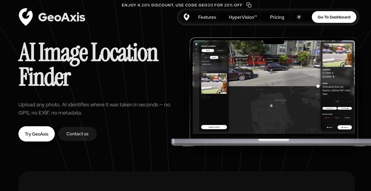
User Interface
The interface is clean and map-focused, making it easy for both beginners and experienced analysts to navigate. Most actions are designed to be visual-first, reducing the need for complex configurations or coding.
Accuracy & Performance
The system is built to handle large-scale spatial datasets while maintaining responsive performance. Whether working with dense urban mapping or broader regional insights, it processes data efficiently without overwhelming the user.
Capabilities
- Spatial data visualization for interactive mapping
- Geographic pattern recognition and clustering
- Location-based trend analysis
- Data layering for multi-source comparison
- Exportable insights for reporting and presentations
Security & Privacy
Data handling is treated with a strong focus on privacy and secure processing. Users working with sensitive geospatial datasets can rely on controlled access and protected environments for their information.
Use Cases
This type of tool is especially valuable in industries where location intelligence plays a key role. Urban planners can use it to study city development patterns, logistics teams can optimize delivery routes, and researchers can analyze environmental changes over time.
It also fits well in business intelligence workflows where location context adds an extra layer of meaning to traditional datasets.
Pros and Cons
Pros
- Highly visual and intuitive interface
- Strong handling of large geospatial datasets
- Useful for both technical and non-technical users
- Flexible analytical capabilities
Cons
- May require time to explore advanced features
- Best results depend on quality of input data
- Some workflows may still benefit from domain knowledge
Pricing Plans
Pricing structures for platforms like this typically scale based on data volume, feature access, and team size. Entry-level access is usually suitable for individuals or small projects, while advanced tiers are designed for organizations that need deeper analytics and collaboration features.
How to Use This Platform
Getting started usually begins by uploading or connecting a dataset that contains location-based information. Once the data is loaded, users can begin exploring it through interactive maps and visualization tools.
From there, filters and analytical layers can be applied to uncover patterns, compare regions, and generate insights. The workflow is designed to feel progressive, guiding users from raw data to meaningful conclusions step by step.
Comparison with Similar Tools
Compared to traditional GIS software, this platform focuses more on accessibility and speed rather than technical complexity. While enterprise GIS tools often require specialized training, this approach prioritizes usability and faster insight generation.
It also stands out from general analytics platforms by putting geography at the center of the experience, rather than treating it as just another data dimension.
Conclusion
For anyone working with location-based data, having a tool that simplifies analysis while still offering depth is a significant advantage. This platform manages to balance usability and power in a way that makes geospatial intelligence more approachable for a wide range of users.
Frequently Asked Questions (FAQ)
Is this platform suitable for beginners?
Yes, the interface is designed to be approachable even for users without prior experience in geospatial analysis.
Can it handle large datasets?
It is built to process and visualize large volumes of spatial data efficiently.
What industries can benefit from it?
Industries such as logistics, urban planning, environmental research, and business intelligence can all benefit from its capabilities.
Does it require coding knowledge?
No, most features are accessible through visual tools, although advanced users may find additional flexibility in more technical options.
AI Data Mining , AI Research Tool , AI Analytics Assistant , AI Maps Generator .
These classifications represent its core capabilities and areas of application. For related tools, explore the linked categories above.

GeoAxis AI Alternatives Product

Aiso

ModelsLab

SEO Tools Hu…

Customer Fee…

IntoTheBlock

QuickFlip.AI

Yorph AI

HostFinder

Kimi K2.5