

















ObservEarth
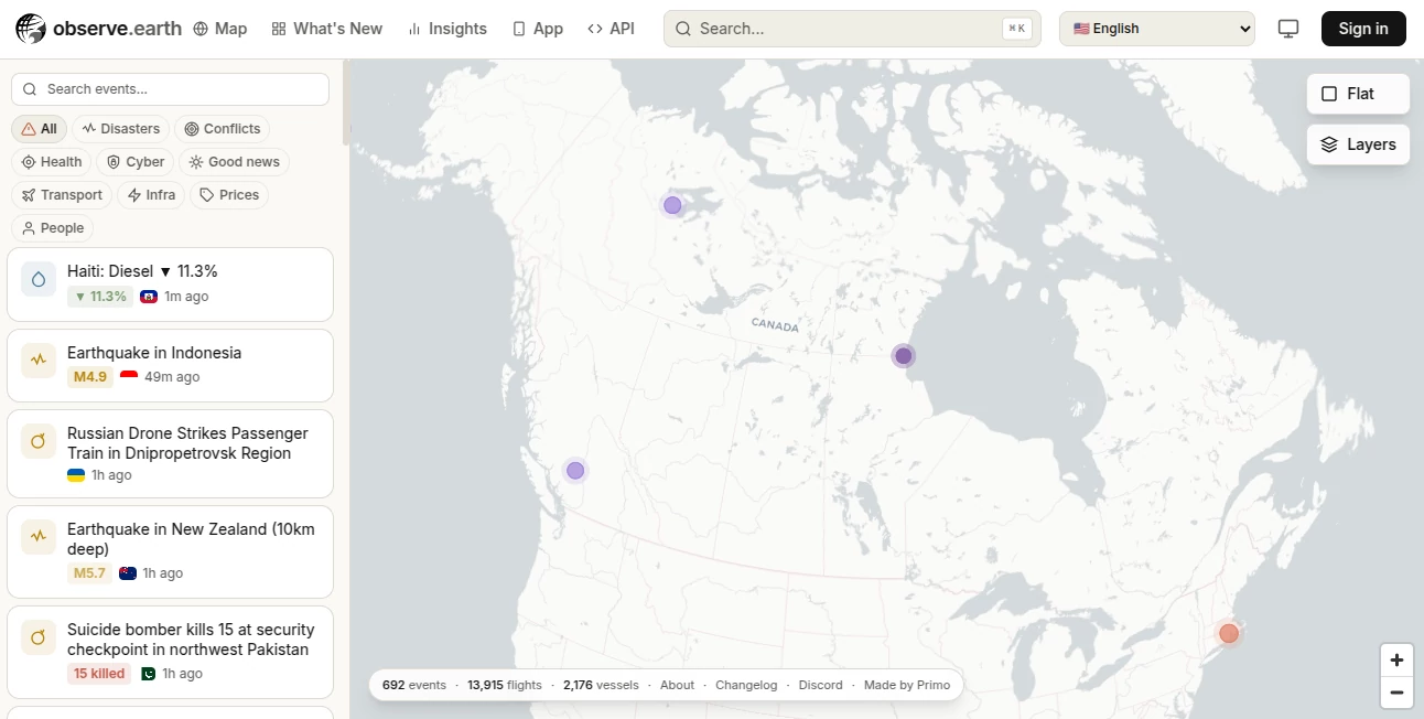
What is ObservEarth?
Modern organizations rely on accurate environmental intelligence to make faster and more confident decisions. This platform transforms complex satellite imagery into practical insights through an intuitive dashboard and developer-friendly APIs. Whether the goal is monitoring agricultural fields, tracking urban expansion, managing forests, or analyzing mining operations, it provides reliable access to historical and real-time Earth observation data without requiring advanced remote sensing expertise.
By combining imagery from multiple satellite sources with weather information and machine learning, users can explore environmental changes, measure land conditions, and automate monitoring workflows. The result is a solution that helps businesses, researchers, and public organizations reduce manual work while improving the quality of their data-driven decisions.
Key Features
User Interface
The dashboard is designed for both technical and non-technical users. Custom Areas of Interest can be created within minutes, satellite layers are easy to visualize, and analytical results can be exported in common formats. Navigation remains straightforward even when working with large geographic regions.
Accuracy & Performance
High-quality satellite imagery from trusted providers is combined with advanced processing algorithms to deliver dependable environmental analysis. Historical records dating back many years allow users to compare seasonal changes, monitor trends, and identify patterns with confidence. Fast processing ensures that reports and imagery remain available when timely decisions matter most.
Capabilities
- Access to optical and radar satellite imagery.
- More than fifty vegetation and environmental indices.
- Historical imagery and environmental datasets.
- Integrated weather information and forecasting.
- Custom Area of Interest monitoring.
- Machine learning models for environmental analysis.
- Land use and land cover classification.
- Change detection across vegetation and urban areas.
- REST API for application integration.
- Export results in GeoTIFF, PNG, CSV, and other formats.
Security & Privacy
API authentication, secure account management, and controlled access help protect user projects and analytical data. Organizations can integrate satellite services into existing workflows while maintaining secure communication between applications and cloud infrastructure.
Use Cases
- Precision agriculture and crop health monitoring.
- Forestry management and deforestation detection.
- Urban growth and infrastructure planning.
- Mining activity monitoring.
- Environmental conservation projects.
- Disaster assessment and recovery planning.
- Water resource management.
- Academic and scientific research.
- Government environmental monitoring.
- Building custom geospatial applications through APIs.
Pros and Cons
- Pros
- Easy-to-use interface suitable for beginners.
- Comprehensive satellite and weather datasets.
- Rich collection of environmental indices.
- Historical imagery covering many years.
- Flexible APIs for developers.
- Supports multiple industries and research projects.
- Multiple export formats for further analysis.
- Cons
- Advanced geospatial concepts may require some learning.
- Commercial projects may require a paid subscription.
- Internet connectivity is necessary for cloud-based processing.
Pricing Plans
A free research and non-commercial plan is available with limited processing capacity, making it suitable for educational and personal projects. Paid subscriptions start at approximately $25 per month and offer increased processing limits, commercial usage, expanded API access, and additional capabilities. Enterprise solutions are also available for organizations with custom requirements.
How to Use ObservEarth
Create an account, define an Area of Interest, select the preferred satellite dataset, and choose the desired analytical layer such as vegetation indices or weather information. Review the generated visualizations, compare historical observations, and export reports or integrate the results into existing applications through the provided REST APIs.
Comparison with Similar Tools
Compared with many traditional geospatial platforms, this solution emphasizes accessibility alongside professional analytical capabilities. While some alternatives require extensive programming knowledge to perform advanced analysis, it provides ready-to-use dashboards, preconfigured indices, integrated weather data, historical imagery, and developer APIs that significantly reduce implementation time. This balance makes it attractive for both experienced geospatial professionals and organizations entering Earth observation for the first time.
Conclusion
Organizations that depend on environmental intelligence often face the challenge of turning massive satellite datasets into actionable information. This platform simplifies that process through an impressive combination of satellite imagery, weather analytics, machine learning, and flexible APIs. Its approachable interface, strong analytical capabilities, and broad industry support make it an excellent choice for agriculture, forestry, environmental management, urban planning, and research. It delivers meaningful insights while reducing the complexity traditionally associated with remote sensing technology.
Frequently Asked Questions (FAQ)
What industries benefit the most from this platform?
Agriculture, forestry, mining, urban planning, environmental monitoring, research institutions, and government agencies are among the primary users.
Does it provide historical satellite imagery?
Yes. Users can access historical imagery and environmental datasets covering many years for trend analysis and long-term monitoring.
Can developers integrate the service into their own applications?
Yes. REST APIs allow developers to access imagery, analytics, weather data, and other services programmatically.
Is there a free version?
Yes. A research and non-commercial plan is available with limited processing capacity for educational and personal use.
Can analytical results be exported?
Yes. Results can be exported in multiple formats including GeoTIFF, PNG, and CSV for additional analysis or reporting.
AI Research Tool , AI API Design , AI Analytics Assistant , AI Maps Generator .
These classifications represent its core capabilities and areas of application. For related tools, explore the linked categories above.
ObservEarth details
Website unavailable — View Alternatives
Pricing
- Free
Apps
- Web App
- iOS App
- Windows App
Categories

ObservEarth Alternatives Product

FeatureShark
Atracker

GEO Checker

SuperAI

Skygen AI

Pinpoint Ans…

DidYouSEO

WhatsMyName …

X Growth Eng…
