

















RoadVision AI
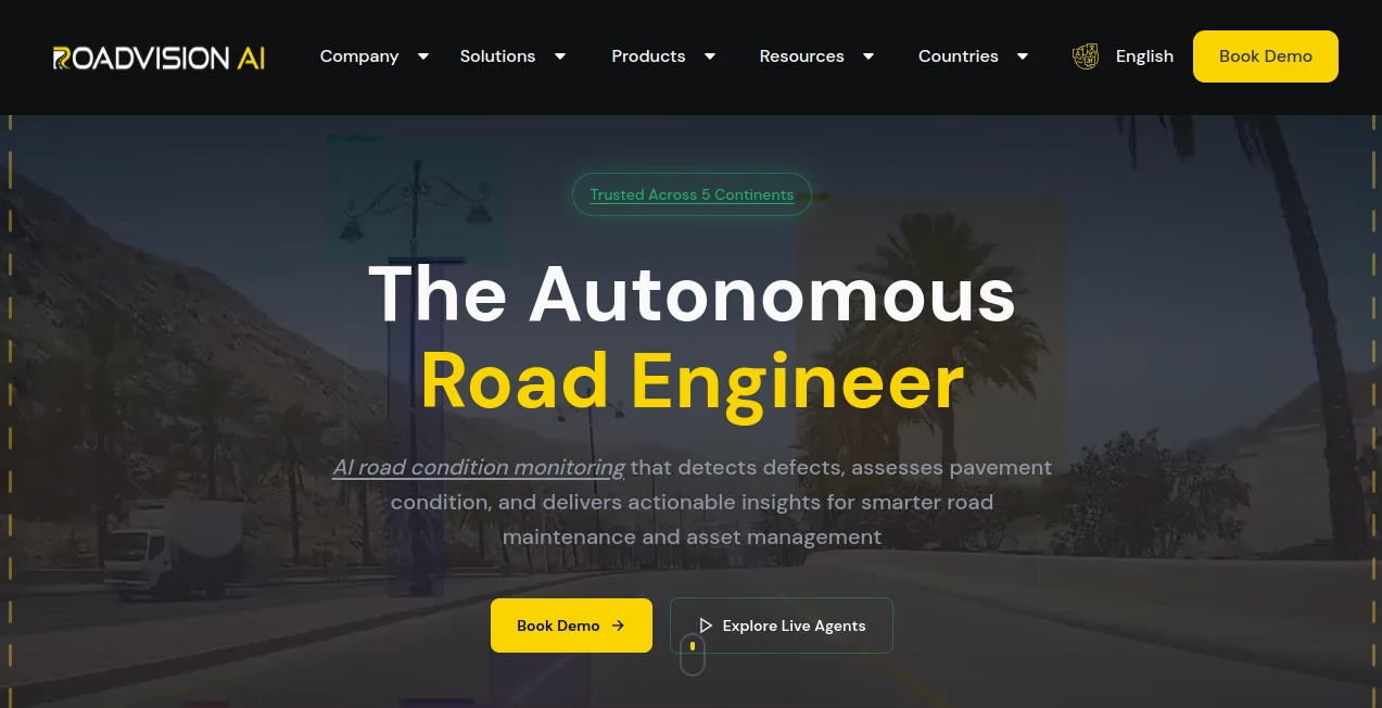
What is RoadVision AI?
Modern road networks are becoming larger, more complex, and more difficult to manage with traditional inspection methods. RoadVision AI introduces an intelligent approach to infrastructure monitoring by using artificial intelligence, computer vision, and automated analysis to help organizations understand road conditions faster and make better maintenance decisions.
Designed as an autonomous road intelligence platform, this solution helps road operators, governments, consultants, and infrastructure teams transform raw visual data into actionable insights. Instead of relying only on slow manual surveys, teams can analyze road conditions continuously and identify issues before they become expensive repairs.
The platform works with data collected from sources such as dashcams, drones, satellites, and existing survey systems. It can detect pavement problems, analyze roadside assets, monitor safety conditions, and deliver structured reports that support smarter infrastructure planning.
Key Features
- AI-Powered Pavement Assessment: Automatically identifies road defects, evaluates severity, and supports condition-based maintenance planning.
- Computer Vision Detection: Uses advanced visual intelligence to recognize cracks, potholes, surface damage, and other road-related issues.
- Multi-Source Data Processing: Supports information collected from cameras, drones, satellites, and existing infrastructure systems.
- Road Intelligence Agents: Provides specialized AI workflows for pavement monitoring, traffic analysis, safety auditing, and asset management.
- Predictive Maintenance Insights: Helps teams understand deterioration patterns and prioritize future repair activities.
- Enterprise Integrations: Connects with GIS platforms, asset management systems, and operational tools through APIs.
- Automated Reporting: Generates structured insights, maps, and reports to simplify decision-making.
User Interface
The platform is designed for infrastructure professionals who need clear visibility rather than complicated technical dashboards. The interface organizes complex road data into understandable insights, allowing users to quickly review detected issues, analyze locations, and plan maintenance activities.
Interactive dashboards help teams move from scattered inspection records to a centralized view of their entire road network. Whether managing a small regional network or thousands of kilometers of highways, users can access important information without spending hours processing raw data.
Accuracy & Performance
The system is built around AI models trained on large volumes of road imagery and engineering data. It can identify multiple road distress types and evaluate conditions based on recognized infrastructure standards.
By reducing manual inspection dependency, organizations can improve consistency, increase survey coverage, and receive updated information more frequently. The platform has been deployed across multiple countries and validated against professional inspection workflows.
Capabilities
The solution goes beyond simple defect detection. It acts as an intelligent assistant for complete road lifecycle management.
- Automatic pavement condition analysis
- Road damage detection and classification
- Traffic analysis and vehicle monitoring
- Roadside asset inventory management
- Road safety assessment support
- Construction progress monitoring
- Disaster-related road damage evaluation
- Integration with existing GIS and asset platforms
Security & Privacy
Security is an important consideration for infrastructure organizations handling large-scale operational data. The platform follows enterprise-focused practices and supports secure integrations, controlled access, and professional data management workflows.
Organizations maintain control over their infrastructure information while using AI capabilities to improve inspection efficiency and operational visibility.
Use Cases
This technology is useful for a wide range of infrastructure scenarios where accurate and timely road information is essential.
- Government Agencies: Improve transportation planning, budget allocation, and public infrastructure monitoring.
- Road Operators: Monitor network conditions continuously and reduce unexpected maintenance costs.
- Construction Companies: Track project quality, compliance, and completion progress.
- Asset Managers: Build long-term maintenance strategies using reliable condition data.
- Engineering Consultants: Complete more inspections without increasing manual workload.
- Infrastructure Investors: Evaluate road assets and understand operational risks.
Pros and Cons
Pros
- Reduces dependence on time-consuming manual inspections.
- Provides scalable road monitoring across large networks.
- Supports multiple data sources and existing systems.
- Transforms visual information into practical maintenance insights.
- Helps organizations move from reactive repairs to predictive planning.
Cons
- Best suited for organizations managing significant infrastructure networks.
- Enterprise deployment may require technical integration planning.
- Pricing information depends on project requirements and deployment size.
Pricing Plans
Pricing is customized based on factors such as network size, monitoring requirements, deployment model, and integration needs. Organizations can choose flexible solutions designed for different infrastructure scales, including usage-based assessments and enterprise deployments.
A personalized consultation is typically required to determine the most suitable package for each organization.
How to Use RoadVision AI
Getting started involves connecting road data sources, configuring the required monitoring workflows, and allowing the AI system to process infrastructure information.
- Collect road imagery or connect existing survey data.
- Upload or integrate information through supported platforms.
- Allow AI models to analyze road conditions and assets.
- Review generated insights, reports, and maintenance recommendations.
- Integrate results into existing operational workflows.
Comparison with Similar Tools
Traditional road inspection software often focuses on storing survey information, while modern AI-powered platforms add intelligence by automatically analyzing visual data and identifying potential problems.
Compared with manual inspection approaches, this solution provides faster analysis, broader coverage, and more consistent evaluations. Compared with basic mapping tools, it offers deeper infrastructure intelligence by connecting detection, prediction, and maintenance planning in one workflow.
Conclusion
RoadVision AI represents a new generation of infrastructure technology that helps organizations understand and maintain roads with greater speed and accuracy. By combining computer vision, artificial intelligence, and engineering workflows, it turns everyday road data into valuable operational knowledge.
For governments, operators, and infrastructure professionals looking to improve road safety, reduce maintenance costs, and make data-driven decisions, this platform provides a powerful foundation for smarter transportation management.
Frequently Asked Questions (FAQ)
What does this platform do?
It uses artificial intelligence and computer vision to analyze road conditions, detect infrastructure issues, and provide insights for maintenance and asset management.
What types of road problems can it identify?
The system can detect various pavement defects, surface damage, road assets, and other infrastructure-related conditions depending on the configured AI models.
Can it work with existing infrastructure systems?
Yes. It is designed to integrate with GIS platforms, asset management systems, and enterprise workflows through available integration options.
Does it require special hardware?
The platform can work with different data sources, including standard vehicle cameras, existing survey footage, drones, and other available infrastructure data.
Who can benefit from using this technology?
Road authorities, infrastructure operators, construction companies, consultants, and asset managers can use it to improve monitoring and maintenance decisions.
AI Data Mining , AI Developer Tools , AI Research Tool , AI Maps Generator .
These classifications represent its core capabilities and areas of application. For related tools, explore the linked categories above.

RoadVision AI Alternatives Product

Website Clon…

Fugte

Rank++

GLM 5

Somnio

ShipAhead

Jujutsu Zero…

DDS Gub

Agent Grid
