
🧠 AI Quiz
Think you really understand Artificial Intelligence?
Test yourself and see how well you know the world of AI.
Answer AI-related questions, compete with other users, and prove that
you’re among the best when it comes to AI knowledge.
Reach the top of our leaderboard.


GLandNav
Precision Farming Simplified with GPS Guidance
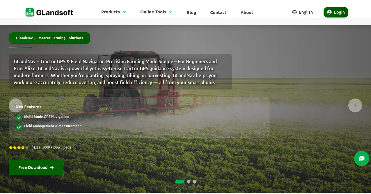
What is GLandNav?
In the demanding world of modern agriculture, tools that boost efficiency without complicating daily tasks are invaluable. GLandNav emerges as a reliable companion for farmers and land managers, offering straightforward GPS solutions that make fieldwork more precise and productive. This platform combines practical apps to handle everything from tractor navigation to area measurements, helping users save time and resources in their operations.
Introduction
GLandNav has been crafted to address the real-world challenges faced by those in agriculture and related fields. It brings together a collection of mobile applications focused on GPS-based guidance and measurement, designed for use on smartphones and tablets. Whether you're a seasoned farm owner or an agricultural consultant just starting out, this service provides the tools needed to optimize fieldwork. Over the years, it has gained traction among professionals who appreciate its blend of simplicity and effectiveness, allowing for better decision-making on the ground and ultimately leading to cost savings and higher yields. As farming practices continue to evolve, GLandNav stays relevant by supporting essential tasks like planting and spraying with dependable technology.
Key Features
User Interface
The design of GLandNav prioritizes ease of access, with layouts that guide users through functions without overwhelming them. Testimonials from users highlight how quickly they can pick up the basics, thanks to clear menus and responsive controls that work well even in rugged outdoor conditions. This approach ensures that anyone, regardless of tech savvy, can navigate the apps smoothly and focus on their tasks rather than troubleshooting.
Accuracy & Performance
When it comes to reliability, GLandNav delivers consistent results that users can count on during critical operations. Field tests and user feedback point to precise measurements and guidance that minimize errors, helping maintain steady performance across various terrains. The system's quick processing keeps things moving without delays, which is especially important in time-sensitive activities like harvesting.
Capabilities
GLandNav extends its utility through a variety of functions tailored to practical needs. Users can rely on it for directing equipment accurately to avoid overlaps, calculating land dimensions on the spot, and handling different mapping formats. Additional strengths include data storage for points of interest and seamless sharing across devices, making it a versatile asset for managing larger projects or multiple sites.
Security & Privacy
Given the nature of fieldwork data, GLandNav takes steps to protect user information by keeping processes local where possible and avoiding unnecessary data collection. While specifics on advanced protections aren't detailed, the emphasis on straightforward, device-based operations helps ensure that sensitive location details remain under user control, fostering trust in everyday use.
Use Cases
Farmers often turn to GLandNav for guiding tractors through rows during seeding or application rounds, cutting down on wasted efforts and inputs. Consultants use the measurement features to assess plots rapidly for client reports, while managers in construction or real estate apply it for site evaluations. In group settings, teams benefit from shared data access, coordinating efforts more effectively across expansive areas.
Pros and Cons
Pros:
- Straightforward apps that integrate well with mobile devices for on-the-go use.
- Helps reduce operational costs through precise guidance and measurements.
- Supports a range of coordinate systems for flexible fieldwork applications.
- Free trial period allows testing without upfront commitment.
Cons:
- Detailed pricing beyond the trial isn't immediately clear, which might require further inquiry.
- Limited mentions of advanced integration with other farm management software.
- Relies on device GPS, so signal quality in remote areas could vary.
Pricing Plans
Getting started with GLandNav is accessible through a 7-day free trial that unlocks all premium capabilities, complete with technical support and no obligation to continue. After the trial, options likely include subscription-based access tailored to individual or professional needs, though exact costs aren't specified upfront. This model encourages users to experience the full value before deciding on a long-term plan.
How to Use GLandNav
To begin, download the appropriate app from your device's store and sign up for the free trial. For navigation tasks, open the tractor guidance feature, set your field boundaries, and follow the on-screen directions while operating equipment. Measuring areas involves selecting the tool, walking or driving the perimeter, and letting the system calculate results automatically. Save important locations in the map section for later reference, and sync data across devices as needed to keep everything organized.
Comparison with Similar Tools
In contrast to broader farm management platforms that might overwhelm with extras, GLandNav keeps things focused on core GPS functions, making it lighter and more direct for daily use. While some competitors offer satellite imagery integrations, this one excels in mobile-first simplicity, though it may lack the depth of enterprise-level analytics found in more complex systems. Overall, it's a strong pick for those prioritizing ease over extensive features.
Conclusion
GLandNav proves to be a practical choice for anyone looking to bring more precision into agricultural and land-based work. Its user-centered design, reliable performance, and versatile tools make it a standout for improving efficiency without added complexity. As users share positive experiences on accuracy and ease, it's clear this platform supports real progress in fieldwork, positioning it well for ongoing success in evolving industries.
Frequently Asked Questions (FAQ)
What devices does GLandNav support?
It works on both smartphones and tablets, ensuring flexibility for various fieldwork scenarios.
How accurate are the measurements?
Users report high reliability, especially when using quality GPS signals from the device.
Is there support during the trial?
Yes, technical assistance is available to help get you started smoothly.
Can I use it for non-farming purposes?
Absolutely, it's useful in construction and real estate for site assessments and mapping.
What if I need to cancel the trial?
You can do so anytime without any charges, keeping things hassle-free.
Other .
These classifications represent its core capabilities and areas of application. For related tools, explore the linked categories above.
GLandNav details
This tool is no longer available on submitaitools.org; find alternatives on Alternative to GLandNav.
Pricing
- Free
Apps
- Web Tools
Categories
GLandNav Alternatives Product

Tea Checker

Clean Paste

Free AI Dire…

Astrologer B…

Pokemon Frie…

forge calcul…

Al Maze Gene…

royaldle

Suno list
